
What is 360-degree Aerial Photography?
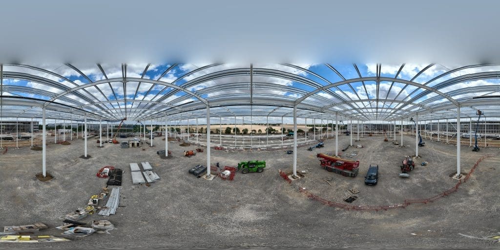
360-degree photography (or VR photography) has been popping up here and there for the last few years, but nowadays 360-degree photos and videos are everywhere and can be captured by camera, drone, or professional scanning equipment to create additional perspectives and incredible immersive marketing content for your business. The surge in 360-degree photography is mainly […]
What is a Drone Survey?
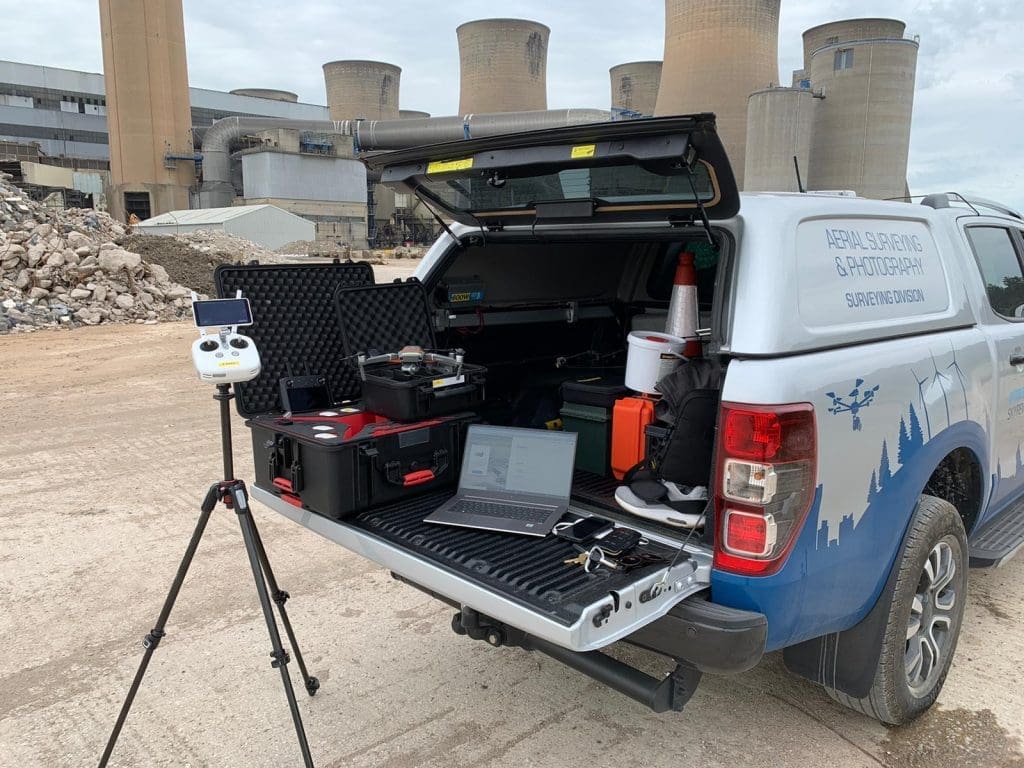
Traditional survey methods can be time-consuming but drone technologies have completely changed the building and land surveying landscape. They have offered the commercial, construction, facilities, civils and developer markets a unique and efficient solution to completing surveys quickly and safely. What do we mean when we use the term ‘drone survey’? Drones are small unmanned aerial […]
What is a Measured Building Survey?
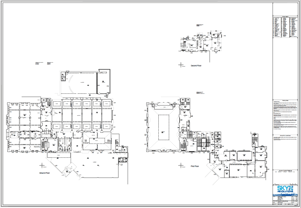
If your business requires an accurate digital representation of a building or structure, then you’ll need a measured building survey. Why? Because a survey can help you make more informed decisions and avoid costly mistakes. Read on to learn more… What is a measured building survey? A measured building survey is a cost-effective method of accurately representing […]
What is a Thermal Survey?

Whether you’re in need of routine surveys of your land or searching for leaks in an area that’s difficult to access, thermal surveys are a top solution that provide a swift and cost-effective result time and time again. So, if you’re wondering ‘what is a thermal survey?’, it’s best to start with the following question: What is […]
What is a Topographic Survey?
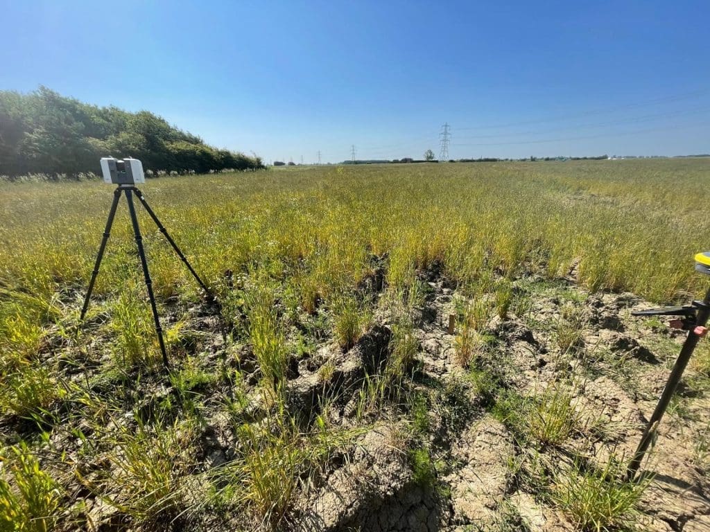
Topographic surveys are a type of land survey that delve deep into the core aspects of your site, capturing all natural and artificial features, from vegetation and terrain to buildings, urban structures and more. These surveys are essential for a variety of purposes, including supporting building or landscaping projects, obtaining planning permission, designing highways, preparing for […]
What is a Utility Survey?

Good question! You may have heard of a utility survey, or even know what it is, but today we’re discussing why they’re so crucial to the future of construction. So, if you’re looking to add an extension to your home or need to check that your construction site is safe to build on, then read […]
What is an Aerial Survey Used For?
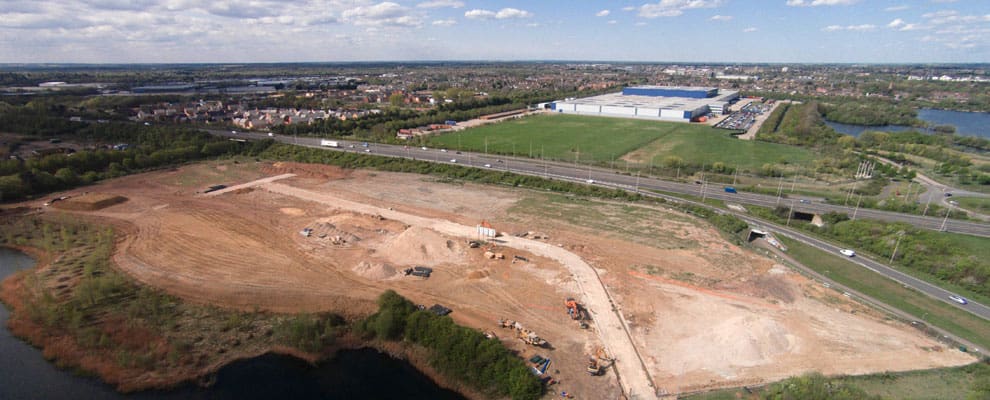
An aerial survey is a simple way of accessing an overall view of large areas from the air and at height. Commonly, an aerial survey is completed using a drone and this provides a cost-effective way for engineers, construction companies and surveyors to see in great detail the land or property in question. It is often difficult […]
What is Construction Timelapse?
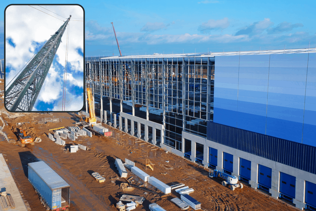
Are you looking for a powerful way of capturing the hard work that goes into your business’ construction work? Timelapse videos are the most cost-effective way of captivating your audience and showing the energy and passion that goes into your construction work. What is a construction timelapse video? A construction timelapse video is a way […]